The weather down here is notorious for being unreliable, and it lived up to its name. In general, though, it was pretty good when we needed it to be. The first day started off with a short but steep hike up the Valle Ascencio. It was only about 10km but with enough food for eight days and a tent on our backs it was pretty tough.


It rained quite a lot that night so we woke up quite wet and very cold. Some morning coffee got the blood running and we headed down to the nearest paid campsite to steal their hot water and try to warm ourselves up. We were in a bit of a rush when buying supplies - the cereal I'd bought turned out to be a low fat, get-in-shape type cereal - not what you really want for calorie-burning hiking. According to the box I will be ready for my bikini in 14 days. Oh yes.

Day two was going to be a long day. We planned to walk all the way to the next free campsite, Italiano, in the Valle Frances, about 24km. We soon dried off and passed a wonderful bit of countryside, rolling green hills and gleaming-blue lakes giving way to snowy mountains.

It would have been an easy day if it hadn't have rained, but it poured down for the last hour, so we arrived dripping wet! Munching through another kilogram of food dried us off and warmed us up and we were ready to head up the valley the next day.
Walking up the valley the next morning was like approaching Mordor. Dense, low-hanging cloud masked the surrounding mountains, and every few minutes a huge thunder-like rumbling reverberated down the valley as huge chunks of ice snapped off the Glacier del Frances and crashed down the mountainside.
Once we gained some altitude there were short moments where a gap would form in the clouds, revealing various mountain tops. I would have rather had a completely clear day with a panoramic view, but it did produce some spectacular effects, like floating rocky castles in the sky or windows into other dimensions...


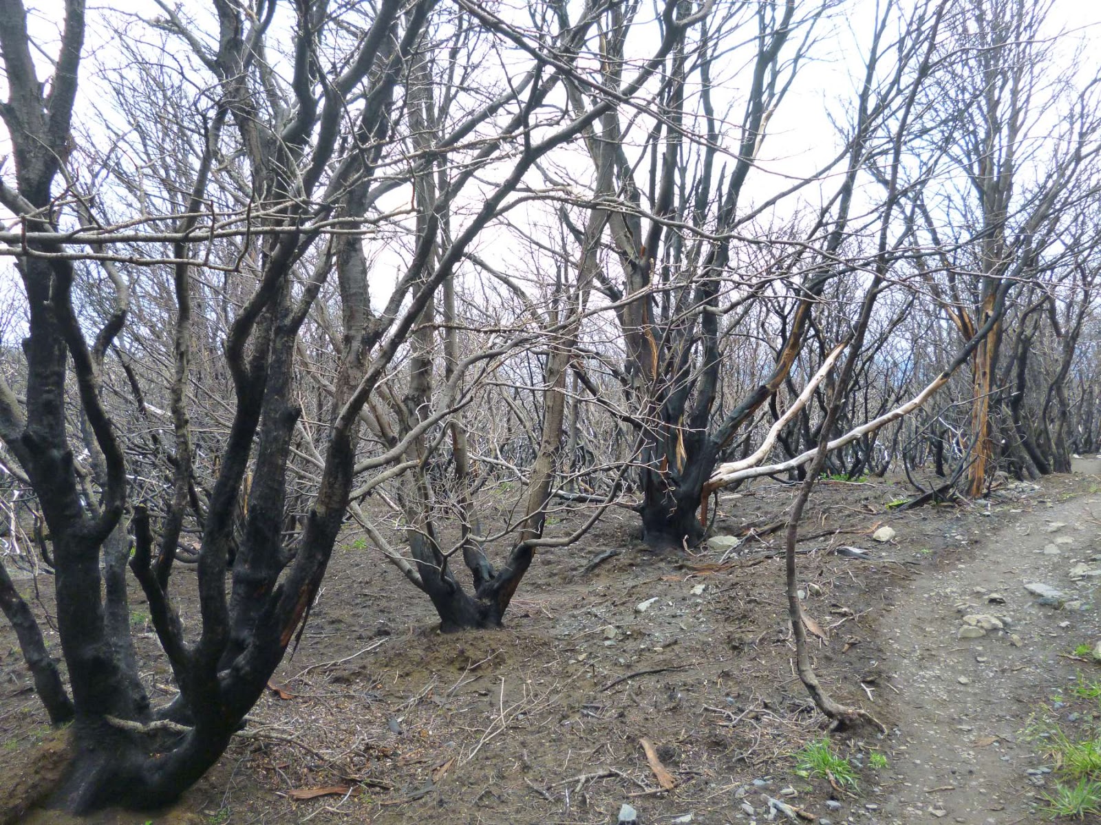
After coming back down, we packed up the tent and headed off on a fairly flat 20km walk to Refugio Grey, right next to Glacier Grey. This took us into the section of the park that was largely burned down only 11 months ago when an Israeli hiker tried to light a campfire by burning a roll of toilet paper. You can easily see the line of devastation and even now, almost one year on, the area smells of burnt stuff - hopefully nature will take over and clean it all up soon.

After a lot of burnt trees, we were really excited when we encountered Glacier Grey! It stretches 28km into the mountains and has an area of 270km², just a bit bigger than the Perito Moreno glacier in my last post. Unlike that glacier, I was going to be able to hike right along Glacier Grey the next day!


We had a lie in and got going at about 10am. About 10 minutes later disaster struck. Simon had been feeling weird all morning and realised that he had some kind of stomach bug/food poisoning. In the end, he decided that he couldn't go on. Ironically, this was on the one day where we weren't doing much walking.
He wasn't particularly bothered about this - he'd completed the W-trek and wasn't too keen on the idea of hiking the mountain pass part of the circuit anyway - but I had a decision to make. Hiking these kind of long treks alone is not normally recommended, so I should probably have gone home too. But I had been waiting to do this trek for aaaages, especially the mountain pass section. In the end I decided to go it alone.
The downside was that this meant that I had to take all of the shared weight myself. I loaded up the rest of the food and the cooking stove onto my bag, made sure Simon was OK to get back to the campsite and headed off to the next campground, Camp Paso. About three minutes later it started snowing quite heavily. This coincided with a rather slippery ladder climb up the side of a large riverbank - I must have done something bad to deserve this.

The rest of the route was right along the glacier. It took ages because I kept stopping to marvel at its beauty.

I was at fairly high altitude that night and it snowed quite heavily. The temperature got down to -11 degrees Celsius which my pitiful sleeping bag, designed for weather conditions between +12 and +18 degrees Celsius, did not handle well - I did not get much sleep. To add insult to injury, all my stuff froze (water, toothpaste, food), which was a bit annoying. On the plus side, I was already dressed when I got up in the morning.
Everyone I met who had hiked the pass from the other direction mentioned lots of mud. I therefore got a really early start so that I was walking when the ground was still frozen. This strategy paid off massively and I was standing on top of the pass after only an hour. All the way up was along the glacier and the weather was perfect - it was the nicest morning's walk I have ever done in my life.


Everywhere I looked there were fantastic jagged mountains and it all put me in a trance. I sat there in the sun for over an hour before I realised that I was so cold my fingers had stopped working.


After coming down the other side of the mountain pass the trail passed through an old forest. This place had definitely not been burned down recently and was filled with huge old trees. It looked like they could come alive (Lord of the Rings-style) if there was ever a battle that threatened their territory. One battle they are already waging is against the termites, who have taken down some seriously big trees over the years.

I arrived at Refugio Dickson. This is the most beautiful spot I have ever seen to pitch a tent. On one side there is a lake with a glacier tumbling into it, flanked by the snowy peaks that feed it...

....and on the other side there are rolling meadows and rocky mountains. Other than a free massage, there is nothing that could have made it better.

I'd met a German couple along the way and spent the next day trekking with them. Over the 19km the land changed from rocky mountainside, to marshy wetland, to huge meadows filled with large daisies. This place has everything!


The last day was less interesting as it was the scene of an even bigger fire in 2005. The green has returned but the trees have not.

I did, however, meet a cheeky llama - who walked along with me for 500m trying to convince me to give him some food. I'd already eaten it all so he was out of luck.

And that brought me to the end of the trail. 130km had been conquered, several types of weather had been endured, and some beautiful sights had been seen. My feet also hurt. Time for some relaxing!
Another great view from the mountain pass. The poor soles doing the trek from the opposite direction have to climb this huge patch of snow. I slid down it in about 22 seconds.

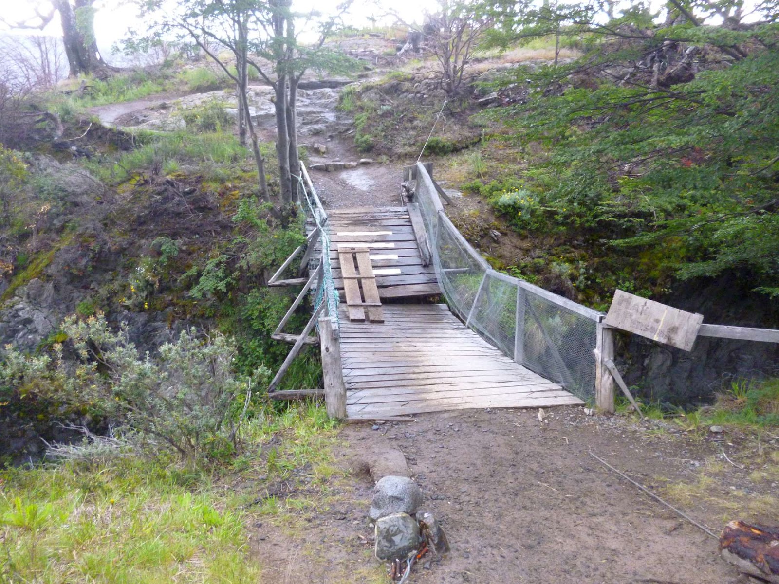
This park collects millions of dollars each year - it is not spent upgrading their bridges.
First footprints of the day - not surprising as I started walking at 6:30am!

The altitude is relatively low but we are wayyy South here - snow everywhere.

More mountains reaching up to the sky.

One of the best things about this national park is that every stream and river contains drinkable water, so you don't have to carry it in yourself. It is always cold and tastes amazing - Evian eat your heart out.

Around the back of the towers.

The view over Refugio Dickson - glacier, mountains and lake. This glacier wasn't even deemed good enough to be mentioned on the map!

No comments:
Post a Comment